The Trip Report: Alright another work conference. This one is in Florida, a long way from Calgary. Rich and I are going. We've agreed to take a weekend extra time and check out the area. Rich calls around and searches the internet and decides he really wants to see the mangroves and everglades. It seems Global warming may really changes Florida in the future and possibly wipe them out. This sounds good to me, seeing them not wiping them out.
It is great having a co-worker and friend like Rich he is super keen to get out and see the world. I get to tag along once in a while. Rich has decided on canoe camping in the mangroves. The put in is at a place called at Everglade City. He's confirmed that Crocodiles donít usually come that 'far' North, and since it is salt water there are no alligators. The girl at the wardenís office he is calling mentions, it is the sharks you need to worry about, but they are not that common. She tells him a couple of times that the views of the sunsets are spectacular.
So that is the plan, two nights out in the Thousand Islands park, off the West coast of Florida.
Our conference is in Orlando, which is not all that close, it looks like a 3 hr drive. So we are up early to drive out to Everglade city. We've got a GPS, but neither are used to them we end up taking a scenic route, which adds a couple of hours to the drive time. So we pull in to Everglade city a bit later than planned.
Everglade "City" is not that big a place, I don't know how big, but I'd be surprised if it was over a 1000 people. We get to the ranger station, and are talking with the girl there. She thinks we are to late already and does not recommend heading out. She also mentions that the tide is against us, as it is now at high tide. This confuses Rich and I, but what do to guys that live 1000km from the nearest oceans know about tides.
We need some gear, off to go shopping, about an hour later we are back. Shopping took longer than it should have. We got some water at the local hardware store... very creepy looking water. The lady at the store pulls out an article that assures us it is safe to drink. After getting out gear, we get back to the wardens station about an hour later. So now we are really late, but buy a chart of the islands, rent an aluminum canoe, and head out.
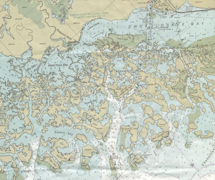
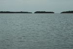
We are able to leave our car at the warden cabin, and launch from just behind it. We have about 1 mile of open water to cross, after that it is more mangrove islands than you can shake a stick at. It could be very easy to get lost in them. Make sure you get a good chart. The warden booked us our first campsite at Tiger key. In part the recommendation is because it is on the outside edge of the islands in the wind, which keeps down the bugs. She also mentions the sunsets. But Iím pretty sure the main reason is because one that we can easily get to, without becoming lost.
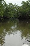
The route out is pretty simple, follow the channel markers, but stay out of the cannel as the crab (or was it shrimping) boats may not see a little canoe. The channel takes us right though a Manatee marine park. We are disappointed to not see any. The water is murky; you cannot see any distance into it.
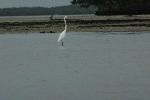
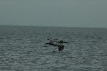
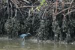
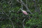
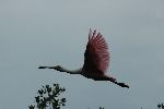
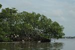
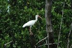
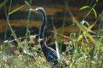
Mangroves are neat, something that I've never seen before. A solid mass of brown roots rising up to about the height of high tide. The roots are encased in barnacles, and thousands upon thousands of small crabs run on the roots. There is little undergrowth, as there is no soil. Lush green canopy above. Lots of birds. Occasional Huge Blue herons, spoon bills, Black and white egrets (I think), occasional pelicans.
It is happy that Rich and I were correct about the tide and the warden had it backwards. We are with the flow most of the way. paddling against it would have been a slog, and would have truly been an issue setting out so late. You cannot just camp anywhere in the mangroves, you need ground.
As we get farther out we are treated to a bit of a spectacle. Long skinny fish that look to be up to 3ft in length are jumping out of the water. The water by the way is extremely silty, you cannot see more than a few inches in any of it. Anyways, these fish would leap 2-5 feet out of the water. It made us wonder what could be chasing such a big fish so that it jumped right out of the water. It is a bit spooky when you are in a canoe, on water you cannot see 4 inches deep into, Especially with thoughts of sharks, alligators and crocodiles.
I noticed later that often if a bird flew over, the fish seemed to jump at the shadow of the bird. Very strange.
We follow the channel markers, it makes it easy to pinpoint where we are on the chart. We decide to explore a bit and take a fairly small channel shown on the map. It takes a while to find it. We can see that it starts in a bay that has an island in front of it, but the forests are so lush, that it is difficult to find the bay. It is difficult to see an island-mangrove sitting 30ft in front of another from 200ft away. In truth it could be very easy to get lost in here.
We do find the channel. It is pretty neat paddling up it with a wall of trees on either side. There is a lagoon in the middle; it is souring water out both sides. So the channel goes from against the current, to with the current as we continue on. Kind of neat for someone who is used to rivers that only flow one way.
As we move around the key (island) where we are going to camp, we transition from being in the mangroves, to being on the edge of the open water of the Gulf of Mexico. The waves have pushed enough bits of shell against the mangroves to result in actual ground in places. We are going past one of the root walls of a mangrove, between two beaches when suddenly there is a frantic race. A fish about a foot long is racing into shore, jumping out of the water as it swims/flys along. There is definitely a bigger fish chasing this one. We do not really see the big fish, but we see its wake. The smaller fish races into shore and is trapped by the mangrove roots. A frantic flurry of splashing, and a much slower wake follows the big fish back out to open water. It's definitely a big-fish little-fish kind of world out her. The struggle for life is very in your face.
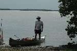
We paddle across the front of a beach that is about 50m in length. There is a port-a-potty on one side of the beach; we decide camp on the other side. We paddle back and beach the canoes.
I'm sure they saw us coming and were waiting for us.
It is a fairly nice sandy beach we walk up. There are lots of small shells, and bits of shells. We do a quick scout of the tent areas, and find some nice areas just inside the trees. Setting up camp we notice that there are the no-see-ums, or black flies, or something like them. Whatever the name, they are tiny little bugs that seem to be flying teeth. We get the tents setup just inside the tree line.
The trees at the end of the beach are nothing like those at home, nor are they the ubiquitous mangrove trees. There are fig trees, cactus, and trees I do not recognise.
Finally we decide we need to put on the bug spray. I've bought some new spray just for this weekend. I guess I should have paid more attention, it is citronella based spray. This spray does NOT work for these bugs, in fact I now suspect it attracts them.
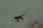
Our tents are up, and we head back to the beach. Occasional gusts of the slightest breeze seem to help. We do spend some time walking along the beach. The channel between Picnic Key and Tiger Key has a current in it, looks almost like a river back home. I take 3 very small shells for my girl back home. There are many small lizards (skinks?) running around, I catch a couple. We light a small beach fire and chill out for a bit, watching the fish jump out on the ocean. It's been a fairly enjoyable day but it is getting dark, and the bugs are getting more prevalent, so we head off to bed.
The "sleep" from hell.
Being from the 'North', I'm not used to it being so hot at night. I have a nylon sleeping bag liner. Even that is uncomfortable. The problem is that there are hundreds of the teeth bugs in my tent. I'm not sure why such a tiny bug can take a bite that is actually noticeable. When you are trying to sleep and there are little chunks of flesh being stripped from your body it is frustrating. Pulling up the cover helps, but I can't sleep like that either way too hot and sticky.
I finally come to the conclusion that when they are full they'll stop eating me. They never seemed to get full. It was a long and annoying night. We had convinced a female co-worker to come with us on the canoe trip, but she could not get a flight out in time to join us. Iím happy for her she missed it.
The next morning I was up before Richard. Looking out the screen I do not like what I see. The normally white bug screen is about 30% covered in tiny black bugs. I've put an extra tarp over my tent; there are black bugs all over it too. I get dressed, and make a break for the beach, getting out of the shelter of the trees. I of course bring lots of bugs with me.
I spend the next 20minutes pacing up and down the beach. Using a shirt to whip my back with, swiping my arms, and grumbling to myself. Richard eventually comes out of his tent. We both agree immediately that we are not going to put up with another night like that.
Walking along the beach mostly marvelling about the evil bugs, or marvelling about the scenery, is nice enough. Two comments of Richards stick out in my mind. First he nearly exactly echoed my thoughts last night on the annoyance of the bugs, stating that he gave up and just let them bite figuring they'd get their fill. He said he had used his flash light later and was watching as they "flowed like water' into his tent at the small gap between the two zipper heads.
Richard figured out what all the little crabs eat. In the night two crabs were scurrying on his tent, he was watching them snap up the little flying teeth bugs, and pop them in their mouths. Florida needs more of these crabs.
Breaking camp is not fun. We want to absolutely minimise our time off the beach. We pull down the tarps and drag them to the beach to fold up there, only a few thousand of the teeth bugs follow us. It is a mixture of cursing, jumping slapping, running from the tarp, and coming back to make the next fold. Repeat for the tents.
One other unhappy note on our campsite: There was a smell that I noticed at the campsite, but did not really register that bad while there. However this smell but that absolutely got all over my tent, and gear. Yuck. I cannot explain it. I wonder if we picked a spot on the beach that was especially bad, maybe rotting material in the sand or something. It took several washings of the tent in the tub with soap to try and get the smell out, with some success, at least after it dried. I'm not sure what it will be like in the next rain. I had to throw my shoes in the garbage, they were revolting. Several washings with soap, and soaking over night twice did not help.
We did not see any mosquitoes, though, so it could have been worse.
We of course decide on a different route back. We set off from camp, going around the far side of Picnic Island. We are out fairly early and once again are with the tide. It is now coming in. We travel at a more leisurely pace. I at least am a bit spooked by the murky water and all the critters that lurk within. We stay fairly close to the edge of the mangroves. Always present are the roots of the trees running down into the water, covered in barnacles, again there are many small crabs skittering along the sides. And the green canopy above, with groups of white birds all over the place. Not to mention the Fish that do not seem to like staying in the murky water.
Not far into our return trip we are about 10 feet out from the edge of a mangrove, when there is a sudden splash and churn of water caused by something 1/2 the size of the canoe between us and the shore. I'm pretty happy I did not leap out of the canoe, I sure did jump and am sure I let out a little scream of surprise. We are not sure what it was, but it was still there. A large fin was sticking out of the water, just feet from our boat. The fin is speckled, and what we could see was about 8 inches across. We could not see the base of the fin. It was BIG.
We continue along the channel between picnic key and Tiger Key, and then cross Gaskin Bay. Wondering what other big fish lay in the depths beneath us. Now looking the chart, it seems the Depths we are talking about range from around 2 to 8 feet (I assume feet) in most of these bays and channels. Once across the bay, I easily convince Richard we should check out one of the inner bays/fiords/not-sure-what-they-are-called water ways. I have the map and direct him down what looks like a creek, the width of a line on the chart.
This quick side adventure turns out to be very neat, possibly the highlight of the trip. We enter a small channel, a few feet across, and guide our boat under the canopy of the trees. There is a current flowing with us. There is a splash, as some bird or other has dove into the water from the branches. The water way opens up into an inner lagoon, which is filling with water. Very neat and somewhat spooky in a very tranquil sort of way.
We soon know we are not alone in our small lagoon, besides the diving bird, all the white birds, and the thousands of crabs I mean. There are things in the water. We can't see what initially, but are just under the surface, and occasionally zoom by us. A bit freaky, finally after watching many of the wakes from these beasty's swimming just below the surface, we were able to catch glimpses of the fish. They were some kind of manaray or stingray. Little guys about 12 inches in diameter. It was pretty cool, at times there were 4-5 zipping past and around us. It was very surreal. After that it was a quick paddle up out of the channel against the current to get back to the bay.
From here we follow the shore of one of the unnamed, and very confusing shaped mangroves, to the edge and slip down the channel between it and Russell key. We have the current with us and it is a very leisurely paddle, gawking around. The Channel does open up into a couple of small bays, but we press on to the next part of the channel and head out. We have a floating lunch of peanut butter and jam stuffed in soft tortilla shells. yum yum lunch of champions. We do see a couple of boats out fishing in the area, trade a few waves and continue on.
At the end of the channel Richard tells me we can go around a long string of connected mangroves, or cut through a bay, with what looks like it has a small egress at the far side. Through the bay we go. I'm not sure why but this bay felt very tranquil, maybe because we were out of the current of the channel. We cannot see the egress points, but continue on. We are pretty sure, but not 100% so as to where we are. Another one of the Very large tubular fish jumps, but this one fairly close to the boat. We do find the egress out, and are once again in a bit of current. As we go by points, we see that there are oysters just below the surface.
We follow along the far side of arms of mangroves jutting out into Lane cove, eventually coming to the area marked shoals, and Oyster reefs on the chart. There is no current with us now, and a headwind. So a bit of effort is required. There is not enough wind/fetch to really produce canoe swamping waves, and we decide to paddle strait into it rather than cross at the shortest point to other shore, instead taking the shortest route back.
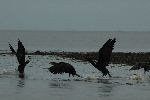
Eventually We do cross, and follow the shore line. Still lots of birds, actually there seem to be more here now. We can hear the roar of one of the fan driven swamp boats as it come tearing up, following the shore from the other side. A large group of white birds take to the air. Hmm the canoe seems to be such a better way to travel, although slower. We spend some time trying to sneak up on birds and get pictures, which is fairly hard to do, as they take to the air.
We come to signs of civilization houses along the banks of one of the rivers flowing into the mangroves. There is a small airport, not far beyond that we arrive back at the ranger station. A bit tired from paddling into the wind (thank goodness the tide was with us for the first half of the day).
The next day:
We consider a hike the next day. We stop in at one of the information buildings, Richard asks about the alligators, pointing to some of the smaller heads in the display, the ones with a snout about 4-6 inches long.. "Are they that big?"... NO says the girl pointing to a large example with foot long mouth agape, like that. She tells us we cannot run from them in a strait path, they'll run you down, you need to zig-zag. We ask her if she has been hiking in the area, she looks at us like we are crazy and says "no way". She recommends a picnic area just down the road where we will see alligators "for sure".
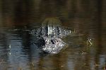
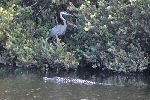
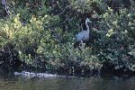
So off we go, at the picnic area, three is a river, but there are no alligators, so we continue up the road a ways, following a car that had been at the same area. They've pulled over and stopped pointing at the river/ditch running next to the road. Sure enough there are alligators in Florida, and yes they are the big ones. We get some very nice pictures.
According to our map the road continues up to intersect another hwy, which we will take back to our hotel. After an hour or so on the road which becomes less and less used. We've got to slow down for large holes in the road, wondering how deep the water is in them. Eventually we get to the Hwy... only the road runs under it and does not join it. A fisherman on the bank confirms the road ends about 3 miles further on at a campsite. sigh. Back we go the way we came. It was an interesting drive though.
Looking back, if it was not for the no-see-ums, or black flies, whatever they were, this would have been a fantastic trip. As it was I've some pretty vivid and interesting memories. If you go, make sure the tide is with you though. Make sure you have good bug protection. An a good map is absolutely required. Iíd also recommend a GPS and compass.
|
