Trail Description:
I arrived at the trail head around 2:30, its a very warm sunny day for Mid Aug.
Steady climb through trees
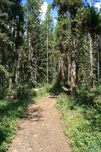
Trail near the put in
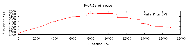
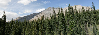
The trip starts from the parking lot just off the old Hwy 1A road. The trail is wide and maintained. Although it is a bit eroded , so that it is not fully even(Aug 2009), but overall in nice shape. The trail has a fairly steady elevation gain for the first few km, perhaps 5km. All this is in the spruce and pine trees of the area, providing occasional openings to view the Bow valley and the mountains around.
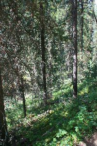
looking down into the creek valley
The path works its way up the side of the hills on a old narrow road, and crosses a few very small creeks. The only critters I see are a few red squirrels. There is a built up walkway over a fairly wide creek/bog area that is mostly dry today. Not sure why it is here, perhaps there is more water in other times.
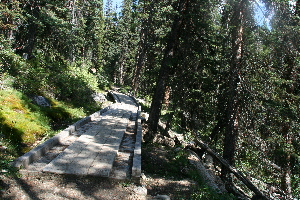
Bridge over.
After the bridge, around the half way point there is an increase in the gradient in the trial. Soon after this it levels out a bit, as you begin to enter the upper valley between Castle mountain and the Helena ridge. There are two small hills that look like they may be old moraines, hills of rocks left by an old glacier as it receded (but maybe not). The trail itself has also changed by this point, it is now less maintained, or the old road did not extend this far, it is now more the dirt and roots type of trail. It is still a wide well used trail.
There is another creek to cross, this time without the aid of a bridge. It is fairly wide, but very low, and flows through a mass of rocks, making it easy to cross without getting your toes wet. At least that was true today. Also the views are starting to be of more than just trees for most of the time. Eisenhower peak has been dominating the view as you go forward.
Helena Ridge
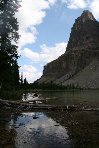
Tower lake, and the Eisenhower tower
As you pass Eisenhower peak on the left, you come to the first lake in the hike, this is Tower lake, a small green blue lake. However it is not Rockbound lake, which as the sign says at the north end of tower lake is still a 1/2 mile further along. The shill whistle of a Marmot is heard echoing over the lake.
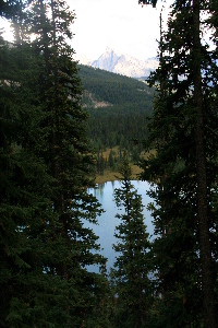
Looking down on Tower Lake
The trail is now a fair bit smaller, although well traveled. The creek out of tower lake must be crossed. At these levels it is easy enough to do with the logs that have been layed out over the small stream. The trail continues to the North of the lake, up a somewhat steep set of switch backs. You soon have a nice view back down onto the lake with several mountains in the distant background.
After the switchbacks the trail levels out, and becomes lost on the bedrock that hold Rockbound lake in place. It is easy to see why the name is chosen for the lake, three sides are held in place by the box canyon here. I had a late start, I'd like to have continued on up around the back side of Protection mountain. But since it is after 5:00PM I figure I should head back. The weather is changing a bit, there is a wind up here, and it looks like a storm could be blowing over Castle mountain. Later it passes to the North, and never hits.
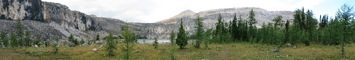
Rockbound Lake, although stretched out
the way back is a direct reverse of the way in. A run in with a pair of grouse on the way down made for an attempted photo op. The did not run or move, until I was ready to press the button to take the picture. The picture here is the best one I got.
I was out by 7:30. There is a short side hike from the parking lot to the Silverton falls. However, I did not make this hike... perhaps another day when I have my daughter with me.
This trail is not technical, however there is between 700-800m elevation gain, making for a fairly good work out for those of us that are not in the best of shape. I'd seen 5 or 6 groups on the trail, it is well used.
As a side note, the following describes Silverton Falls as taken from the billboard at the shared trail head with the Rockbound Lake Trail: This 50 m cascading waterfall is named for Silverton Creek, which wa a name suggested for the nearby mining boom town of Silver city before it went bust in 1885. The trail to Siverton Falls branches from the Rockbound Lake trail 300m beyond this trail head and runs through the forest to a viewpoint near the top of the waterfall.
|